
 Search
 Feedback
 About
About Help
Help News
News
| Listing 1 - 8 of 8 |
Sort by
|
ISBN: 0691010420 Year: 2000 Publisher: Princeton, N. J. Oxford Princeton University Press
Abstract | Keywords | Export | Availability | Bookmark
 Loading...
Choose an application
- Reference Manager
- EndNote
- RefWorks (Direct export to RefWorks)
Ancient geography --- Antieke geografie --- Geografie [Antieke ] --- Geografie van de Oudheid --- Geography [Ancient ] --- Géographie ancienne --- Géographie de l'Antiquité --- Cartography --- Geography, Ancient --- Cartographie --- Ptolemy, --- 912 --- -Geography, Ancient --- Geography --- Cartography, Primitive --- Chartography --- Map-making --- Mapmaking --- Mapping (Cartography) --- Mathematical geography --- Surveying --- Map projection --- Maps --- History General geography Atlases Maps Charts Plans --- Ptolemy --- Geography, Ancient. --- Géographie ancienne --- Ptolemy, - 2nd cent. - Geographia. --- Cartography - Greece - Early works to 1800.
Book
ISBN: 2200018797 Year: 2000 Publisher: Paris : Armand Colin,
Abstract | Keywords | Export | Availability | Bookmark
Loading...Choose an application
- Reference Manager
- EndNote
- RefWorks (Direct export to RefWorks)
Géographie --- Cartographie --- Cartes --- Problèmes et exercices --- Examens --- Guides de l'étudiant --- Géographie --- Problèmes et exercices --- Guides de l'étudiant --- Geography --- Maps --- Cartography --- Cartography, Primitive --- Chartography --- Map-making --- Mapmaking --- Mapping (Cartography) --- Mathematical geography --- Surveying --- Map projection --- CARTES TOPOGRAPHIQUES --- ENSEIGNEMENT --- METHODOLOGIE
ISBN: 352547900X Year: 2000 Volume: 1 Publisher: Göttingen Vandenhoeck & Ruprecht
Abstract | Keywords | Export | Availability | Bookmark
Loading...Choose an application
- Reference Manager
- EndNote
- RefWorks (Direct export to RefWorks)
Painting --- cartography [discipline] --- cosmography --- Iconography --- landscapes [representations] --- Bruegel, Pieter [Elder] --- Lorck, Melchior --- Hoefnagel, Joris --- Doetechum, van, Joannes I --- Vermeyen, Jan Cornelisz. --- Ortelius, Abraham --- Wijngaerde, van den, Anthonis --- anno 1500-1599 --- Art, Dutch --- Art, Flemish --- Art, Italian --- Art, Renaissance --- Cartography --- Cosmography in art --- Landscapes in art --- Landscape in art --- Cartography, Primitive --- Chartography --- Map-making --- Mapmaking --- Mapping (Cartography) --- Mathematical geography --- Surveying --- Map projection --- Maps --- Renaissance art --- Flemish art --- Dutch art --- Ploeg (Group of artists) --- Italian influences --- Themes, motives --- Influence --- History --- Nieuwe Ploeg (Group of artists)

ISBN: 0874174775 9780874174779 0874176182 9780874176186 Year: 2000 Publisher: Reno, [Nevada] ; Las Vegas, [Nevada] : University of Nevada Press,
Abstract | Keywords | Export | Availability | Bookmark
Loading...Choose an application
- Reference Manager
- EndNote
- RefWorks (Direct export to RefWorks)
What Barry Lopez did in expanding our vision of the frozen North in Arctic Dreams, William Fox has done in broadening our perceptions of the desert expanses of the West's Great Basin. Roughly a quarter of a million acres of land spanning much of Utah and most of Nevada, the Great Basin is the highest and driest of the American deserts, a vast empty tract on the nineteenth-century maps of our continent. Explorers and cartographers found it imponderable; pioneers and settlers found it uninhabitable. And today the Great Basin remains a largely unknown and forbidding landscape, one that continues to exercise a powerful influence on human desire and imagination. The Void, the Grid, & the Sign guides us to a place so unusual and disorienting that it can overcome rationality and become the locus for our most fanciful and fearsome projections: mythical rivers, mammoth artistic earthworks, alien spaceships, jet-propelled race cars, and weapons of mass annihilation. In The Void, Fox walks us through this landscape, investigating our responses to the Great Basin's appearance -- a pattern of mountains and valleys on a scale so large, so empty and undifferentiated by shape and form and color, that the visual and cognitive expectations of the human mind are confounded and impaired. The Grid focuses on the evolution of cartography in the nineteenth century and the explorations of John Charles Fremont in his search for the legendary Buenaventura River. Fox invites us on a Great Basin road trip, tracing the net of maps, section markers, railroads, telegraph lines, and highways that humans have thrown across the void throughout history. The Sign considers the language and the metaphors we continue to place around and over the void, revealing the Great Basin as a vast palimpsest where the neon-lined boulevards of Las Vegas overlay and interplay with millennia-old petroglyphs and pictographs. Through vivid and arresting prose drawing from the disciplines of natural history, art history, cognitive psychology, western history, archaeology and anthropology, The Void, the Grid, & the Sign traverses the knowns and the unknowns of the Great Basin, offering a tour de force of inquiry and thought.
Cartography --- Natural history --- Human geography --- Great Basin --- Cartography, Primitive --- Chartography --- Map-making --- Mapmaking --- Mapping (Cartography) --- Mathematical geography --- Surveying --- Map projection --- Maps --- History, Natural --- Natural science --- Physiophilosophy --- Biology --- Science --- Anthropo-geography --- Anthropogeography --- Geographical distribution of humans --- Social geography --- Anthropology --- Geography --- Human ecology --- History. --- Geography. --- Fox, William L., --- Travel --- Basin and Range Province --- Intermontane region --- Intermountain Region (U.S.) --- Intermountain West (U.S.) --- Discovery and exploration. --- Description and travel.
Periodical
ISSN: 24093173 20751893 Year: 2000 Publisher: Kharkiv : Ministerstvo osvity i nauky Ukraïny, Kharkivsʹkyĭ nat͡sionalʹnyĭ universytet imeni V.N. Karazina
Abstract | Keywords | Export | Availability | Bookmark
Loading...Choose an application
- Reference Manager
- EndNote
- RefWorks (Direct export to RefWorks)
geography --- cartography --- education --- Geography --- Cartography --- Study and teaching --- Study and teaching. --- Ukraine. --- Cartography, Primitive --- Chartography --- Map-making --- Mapmaking --- Mapping (Cartography) --- Mathematical geography --- Surveying --- Map projection --- Maps --- Cosmography --- Earth sciences --- World history --- Area studies --- An Úcráin --- Europe --- I-Yukreyini --- IYukreyini --- Malorosii͡ --- Małorosja --- Oekraïne --- Ookraan --- Oukraïne --- Oykrania --- Petite-Russie --- U.S.R.R. --- Ucrægna --- Úcráin --- Ucraina --- Ucrania --- Ucrayena --- ʻUkelena --- Ukraïna --- Ukrainæ --- Uḳraʼinah --- Ukrainian Council Socialist Republic --- Ukrainian S.S.R. --- Ukrainian Socialist Soviet Republic --- Ukrainian Soviet Socialist Republic --- Ukrainio --- Ukrainmudin Orn --- Ukraïnsʹka Radi͡ansʹka Sot͡sialistychna Respublika --- Ukrainska Radyanska Sotsialistychna Respublika --- Ukrainska Sotsialistychna Radianska Respublika --- Ukraïnsʹka Sot͡sii͡alistychna Radi͡ansʹka Respublika --- Ukrainskai͡a Sovetskai͡a Sot͡sialisticheskai͡a Respublika --- Ukrainskaya Sovetskaya Sotsialisticheskaya Respublika --- Ukrainujo --- Ukrajina --- Ūkrāniy --- Ukranya --- Ukrayiina --- Ukrayina --- Ukrayna --- Ukuraina --- Ukyáña --- Wcráin --- Yn Ookraan --- Yr Wcráin --- Yukrain --- Ukraine
ISBN: 0691092591 0691214115 Year: 2000 Publisher: Princeton, N.J. : Princeton University Press,
Abstract | Keywords | Export | Availability | Bookmark
Loading...Choose an application
- Reference Manager
- EndNote
- RefWorks (Direct export to RefWorks)
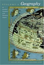
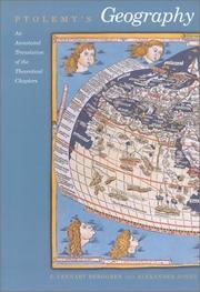
Ptolemy's Geography is the only book on cartography to have survived from the classical period and one of the most influential scientific works of all time. Written in the second century AD, for more than fifteen centuries it was the most detailed topography of Europe and Asia available and the best reference on how to gather data and draw maps. Ptolemy championed the use of astronomical observation and applied mathematics in determining geographical locations. But more importantly, he introduced the practice of writing down coordinates of latitude and longitude for every feature drawn on a world map, so that someone else possessing only the text of the Geography could reproduce Ptolemy's map at any time, in whole or in part, at any scale. Here Berggren and Jones render an exemplary translation of the Geography and provide a thorough introduction, which treats the historical and technical background of Ptolemy's work, the contents of the Geography, and the later history of the work.
Cartography --- Geography, Ancient. --- Ptolemy, --- Ancient geography --- Geography --- Cartography, Primitive --- Chartography --- Map-making --- Mapmaking --- Mapping (Cartography) --- Mathematical geography --- Surveying --- Map projection --- Maps --- Agrippa. --- Aristotle. --- Babylon. --- Baetis. --- Baktra. --- Canopus. --- Carthage. --- Diller. --- Diogenes. --- Dioskoros. --- Ekbatana. --- Erasmus. --- Ganges. --- Hebrides. --- Heron. --- Imaos. --- Issos. --- Julius Maternus. --- Kouroula. --- Londinium. --- Madaba mosaic. --- Marcianus. --- Nasamones. --- Nobbe. --- Pachynus. --- Pappus. --- Ravenna. --- Rome. --- Seleucia. --- Tacitus. --- Theophilos. --- Werner. --- Zeugma. --- graticule. --- horizon. --- league. --- optics. --- parasang. --- precession. --- satrapies. --- zodiac. --- Kartografi --- Geografi --- Cartography. --- Greece. --- al-Yūnān --- Ancient Greece --- Ellada --- Ellas --- Ellēnikē Dēmokratia --- Elliniki Dimokratia --- Grčija --- Grèce --- Grecia --- Gret︠s︡ii︠a︡ --- Griechenland --- Hellada --- Hellas --- Hellenic Republic --- Hellēnikē Dēmokratia --- Kingdom of Greece --- République hellénique --- Royaume de Grèce --- Vasileion tēs Hellados --- Xila --- Yaṿan --- Yūnān --- Ελληνική Δημοκρατία --- Ελλάς --- Ελλάδα --- Греция --- اليونان --- يونان --- 希腊 --- Gret͡sii͡
Book
ISBN: 906194418X 9004475176 Year: 2000 Volume: 1 Publisher: 'Goy-Houten Hes & De Graaf
Abstract | Keywords | Export | Availability | Bookmark
Loading...Choose an application
- Reference Manager
- EndNote
- RefWorks (Direct export to RefWorks)
Een compleet overzicht van alle gedrukte landkaarten van het oude graafschap Holland vanaf 1542 tot aan het begin van het Koninkrijk der Nederlanden in 1815. Holland is in de loop der tijd ingrijpend veranderd door overstromingen, inpolderingen, verveningen, droogmakerijen, stadsuitbreidingen enz. in de provincies Noord- en Zuid-Holland. Deze factoren vonden hun neerslag in het kaartbeeld.
Geodesy. Cartography --- Netherlands --- 912 <01> --- 912 <09> <492> --- 911.375 <09> <492> --- 949.261 --- 949.262 --- Cartografie. Kaarten. Plattegronden. Atlassen--Bibliografieën. Catalogi --- Cartografie. Kaarten. Plattegronden. Atlassen--Geschiedenis van ...--Nederland --- Steden. Studie van stedelijke vestiging. Geografie van steden. Stadsgeografie--Geschiedenis van ...--Nederland --- Geschiedenis van Nederland: provincie Zuid-Holland:--reg./lok. --- Geschiedenis van Nederland: provincie Noord-Holland:--reg./lok. --- 949.262 Geschiedenis van Nederland: provincie Noord-Holland:--reg./lok. --- 949.261 Geschiedenis van Nederland: provincie Zuid-Holland:--reg./lok. --- Cartography --- Cartography, Primitive --- Chartography --- Map-making --- Mapmaking --- Mapping (Cartography) --- Mathematical geography --- Surveying --- Map projection --- Maps --- History --- Geschiedenis van Nederland: provincie Zuid-Holland:--reg./lok --- Geschiedenis van Nederland: provincie Noord-Holland:--reg./lok --- The Netherlands --- Pays-Bas --- Países Baixos --- Holland --- Spanish Netherlands --- Pays-Bas espagnols --- Austrian Netherlands --- Pays-Bas autrichiens --- Oostenrijkse Nederlanden --- Southern Netherlands --- Pays-Bas méridionaux --- Zuidelijke Nederlanden --- Niderlandy --- Belanda --- Nederland --- Koninkrijk der Nederlanden --- Reino dos Países Baixos --- Royaume des Pays-Bas --- Kingdom of the Netherlands --- Países Bajos --- Holanda --- Nederlân --- Hulanda --- Beulanda --- Niderland --- Niderlande --- هولندا --- مملكة هولندا --- Mamlakat Hūlandā --- Olanda --- Payis-Bâs --- Países Baxos --- Aynacha Jach'a Markanaka --- Nirlan --- Niderland Krallığı --- Kē-tē-kok --- Landa --- Kerajaan Landa --- Нидерландтар --- Niderlandtar --- Нидерландтар Короллеге --- Niderlandtar Korollege --- Нідэрланды --- Каралеўства Нідэрланды --- Karaleŭstva Nidėrlandy --- Nederlands --- Niadaland --- Holandija --- Kraljevina Holandija --- Izelvroioù --- Нидерландия --- Niderlandii︠a︡ --- Кралство Нидерландия --- Kralstvo Niderlandii︠a︡ --- Països Baixos --- Нидерландсем --- Niderlandsem --- Нидерландсен Патшалăхĕ --- Niderlandsen Patshalăkhĕ --- Nizozemsko --- Paesi Bassi --- Regnu di i Paesi Bassi --- Iseldiroedd --- Nederlandene --- Niederlande --- Kéyah Wóyahgo Siʼánígíí --- Nižozemska --- Kralojstwo Nederlandow --- Madalmaad --- Ολλανδία --- Ollandia --- Hollandia --- Κάτω Χώρες --- Katō Chōres --- Βασίλειο των Κάτω Χωρών --- Vasileio tōn Katō Chōrōn --- Nederlando --- Reĝlando Nederlando --- Paisis Bajus --- Herbehereak --- Herbehereetako Erresumaren --- هلند --- Huland --- Niðurlond --- Háland --- Paîs Bas --- Neerlande --- Ísiltír --- Ríocht na hÍsiltíre --- Çheer Injil --- Çheer y Vagheragh --- Reeriaght ny Çheer Injil --- Tìrean Ìsle --- Hò-làn --- Недерлендин Нутг --- Nederlendin Nutg --- 네덜란드 --- Nedŏllandŭ --- Hōlani --- Nederlandia --- Pais Basse --- Regno del Paises Basse --- Нидерландтæ --- Niderlandtæ --- Нидерландты Къаролад --- Niderlandty Kʺarolad --- Konungsríkið Holland --- הולנד --- Holand --- ממלכת ארצות השפלה --- Mamlekhet Artsot ha-Shefelah --- Walanda --- Hollandi --- Нидерландла --- Niderlandla --- Нидерландланы Королевствосу --- Niderlandlany Korolevstvosu --- Néderlandzkô --- Нидерланд --- Iseldiryow --- Ubuholandi --- Ubuhorandi --- Nederilande --- Нидерланддар --- Niderlanddar --- Uholanzi --- Ufalme wa Nchi za Chini --- Нидерландъяс --- Niderlandʺi︠a︡s --- Нидерландъяс Корольув --- Niderlandʺi︠a︡s Korolʹuv --- Peyiba --- Holenda --- Keyatiya Nederlandan --- Payises Bashos --- פאייסיס באשוס --- Nīderlandeja --- Batavia --- Regni Nederlandiarum --- Nīderlandes Karaliste --- Nyderlandai --- Nyderlandų Karalystė --- Paixi Basci --- Paes Bass --- Ulanda --- Holland Királyság --- Keninkryk fan 'e Nederlannen --- Reino di Hulanda --- Холандија --- Кралство Холандија --- Kralstvo Holandija --- Pajjiżi l-Baxxi --- Hōrana --- Недерлатт --- Nederlatt --- Оцязорксши Недерлатт --- Ot︠s︡i︠a︡zorksshi Nederlatt --- Нидерландын Вант Улс --- Niderlandyn Vant Uls --- Tlanitlālpan --- Huēyitlahtohcāyōtl in Tlanitlālpan --- Eben Eyong --- Nederlaand --- オランダ --- Oranda --- オランダ王国 --- Oranda Ōkoku --- Ulanna --- Nethiland --- Nederlande --- Holandska --- Holland (Kingdom) --- Batavian Republic --- United Provinces of the Netherlands --- Historical geography
Book
ISBN: 9064697582 9058670740 9789058670748 Year: 2000 Volume: 8.3 Publisher: Leuven: Universitaire pers,
Abstract | Keywords | Export | Availability | Bookmark
Loading...Choose an application
- Reference Manager
- EndNote
- RefWorks (Direct export to RefWorks)
English summary
Cartography --- 911.375 <09> <492> --- 911.375.53 <492> --- Cartography, Primitive --- Chartography --- Map-making --- Mapmaking --- Mapping (Cartography) --- Mathematical geography --- Surveying --- Map projection --- Maps --- 911.375.53 <492> Stadsplattegrond--Nederland --- Stadsplattegrond--Nederland --- History --- Steden. Studie van stedelijke vestiging. Geografie van steden. Stadsgeografie--Geschiedenis van ...--Nederland --- Netherlands --- The Netherlands --- Pays-Bas --- Países Baixos --- Holland --- Spanish Netherlands --- Pays-Bas espagnols --- Austrian Netherlands --- Pays-Bas autrichiens --- Oostenrijkse Nederlanden --- Southern Netherlands --- Pays-Bas méridionaux --- Zuidelijke Nederlanden --- Niderlandy --- Belanda --- Nederland --- Koninkrijk der Nederlanden --- Reino dos Países Baixos --- Royaume des Pays-Bas --- Kingdom of the Netherlands --- Países Bajos --- Holanda --- Nederlân --- Hulanda --- Beulanda --- Niderland --- Niderlande --- هولندا --- مملكة هولندا --- Mamlakat Hūlandā --- Olanda --- Payis-Bâs --- Países Baxos --- Aynacha Jach'a Markanaka --- Nirlan --- Niderland Krallığı --- Kē-tē-kok --- Landa --- Kerajaan Landa --- Нидерландтар --- Niderlandtar --- Нидерландтар Короллеге --- Niderlandtar Korollege --- Нідэрланды --- Каралеўства Нідэрланды --- Karaleŭstva Nidėrlandy --- Nederlands --- Niadaland --- Holandija --- Kraljevina Holandija --- Izelvroioù --- Нидерландия --- Niderlandii︠a︡ --- Кралство Нидерландия --- Kralstvo Niderlandii︠a︡ --- Països Baixos --- Нидерландсем --- Niderlandsem --- Нидерландсен Патшалăхĕ --- Niderlandsen Patshalăkhĕ --- Nizozemsko --- Paesi Bassi --- Regnu di i Paesi Bassi --- Iseldiroedd --- Nederlandene --- Niederlande --- Kéyah Wóyahgo Siʼánígíí --- Nižozemska --- Kralojstwo Nederlandow --- Madalmaad --- Ολλανδία --- Ollandia --- Hollandia --- Κάτω Χώρες --- Katō Chōres --- Βασίλειο των Κάτω Χωρών --- Vasileio tōn Katō Chōrōn --- Nederlando --- Reĝlando Nederlando --- Paisis Bajus --- Herbehereak --- Herbehereetako Erresumaren --- هلند --- Huland --- Niðurlond --- Háland --- Paîs Bas --- Neerlande --- Ísiltír --- Ríocht na hÍsiltíre --- Çheer Injil --- Çheer y Vagheragh --- Reeriaght ny Çheer Injil --- Tìrean Ìsle --- Hò-làn --- Недерлендин Нутг --- Nederlendin Nutg --- 네덜란드 --- Nedŏllandŭ --- Hōlani --- Nederlandia --- Pais Basse --- Regno del Paises Basse --- Нидерландтæ --- Niderlandtæ --- Нидерландты Къаролад --- Niderlandty Kʺarolad --- Konungsríkið Holland --- הולנד --- Holand --- ממלכת ארצות השפלה --- Mamlekhet Artsot ha-Shefelah --- Walanda --- Hollandi --- Нидерландла --- Niderlandla --- Нидерландланы Королевствосу --- Niderlandlany Korolevstvosu --- Néderlandzkô --- Нидерланд --- Iseldiryow --- Ubuholandi --- Ubuhorandi --- Nederilande --- Нидерланддар --- Niderlanddar --- Uholanzi --- Ufalme wa Nchi za Chini --- Нидерландъяс --- Niderlandʺi︠a︡s --- Нидерландъяс Корольув --- Niderlandʺi︠a︡s Korolʹuv --- Peyiba --- Holenda --- Keyatiya Nederlandan --- Payises Bashos --- פאייסיס באשוס --- Nīderlandeja --- Batavia --- Regni Nederlandiarum --- Nīderlandes Karaliste --- Nyderlandai --- Nyderlandų Karalystė --- Paixi Basci --- Paes Bass --- Ulanda --- Holland Királyság --- Keninkryk fan 'e Nederlannen --- Reino di Hulanda --- Холандија --- Кралство Холандија --- Kralstvo Holandija --- Pajjiżi l-Baxxi --- Hōrana --- Недерлатт --- Nederlatt --- Оцязорксши Недерлатт --- Ot︠s︡i︠a︡zorksshi Nederlatt --- Нидерландын Вант Улс --- Niderlandyn Vant Uls --- Tlanitlālpan --- Huēyitlahtohcāyōtl in Tlanitlālpan --- Eben Eyong --- Nederlaand --- オランダ --- Oranda --- オランダ王国 --- Oranda Ōkoku --- Ulanna --- Nethiland --- Nederlande --- Holandska --- Holland (Kingdom) --- Batavian Republic --- United Provinces of the Netherlands --- Historical geography --- anno 1700-1799 --- anno 1800-1899 --- Géographie historique --- Cartes --- Histoire --- 1795-1815 --- Bibliography --- Batavian Republic (1795-1806) --- 912 <09> <492> --- 912 "17" --- 912 "18" --- 949.2.05 --- 949.2.05 Geschiedenis van Nederland:--(1795-1813) --- Geschiedenis van Nederland:--(1795-1813) --- Cartografie. Kaarten. Plattegronden. Atlassen--Geschiedenis van ...--Nederland --- Cartografie. Kaarten. Plattegronden. Atlassen--18e eeuw. Periode 1700-1799 --- Cartografie. Kaarten. Plattegronden. Atlassen--19e eeuw. Periode 1800-1899 --- Nederland. --- Cartography - Netherlands - History - 19th century. --- Cartography - Netherlands - History - 18th century.
| Listing 1 - 8 of 8 |
Sort by
|